Tim Peters of 1st Balmoral Venturers recounts the events of his recent Queen’s Scout Expedition in the Blue Mountains.
This hike was originally intended to be from Katoomba to Mittagong over 6 days however due to the lack of experienced hikers that I could find to come along I decided to alter the course to Kanangra Walls. This made it a four-day trek, slightly easier yet still very challenging. I would like to thank my four friends that participated on this hike Oscar Steward, Antony Gould, Oliver Wood and David Hughes. They varied greatly in experience but they all put in what they could over the four days.
Day 1
The first day began in Sydney at my house at 5:30am in the morning. Everyone arrived, packed the car and we were off by 6:00am. A quick stop at Concord Maccas was in order to give everyone the energy for the hard day ahead. This aside we got on the M4 and headed out to the Blue Mountains.
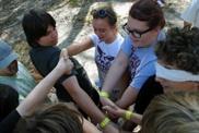
We arrived at 8:00 on the corner of Glenhapel and Cliff Drive for the start of the hike. At first when I opened the door I thought it was freezing cold outside, I didn’t have this feeling again over the next four days. We unloaded the car, had the mandatory picture that mom had ordered from back in Sydney and we were on our way.
The walk along Glenhapel Drive, a fire trail, was quite peaceful and a great way to start the hike. To the west lie great views of the Western Blue Mountains, including the Wild Dog Mountains and Megalong Valley. To the east are the views out to Mount Solitary and Jamison Valley, the area that I had done my Green Cord Expedition over three years before.
We arrived at Bushwalkers Hill around 11:00am, and started to talk to two local bikers about where we were headed. Bushwalkers Hill consists manly of a Fire Lookout point, which was manned that day by a someone, and an outback toilet. The toilet isn’t worth holding your breath for. We had a short break and we were off again.
As we continued on, it started to get hot, only a start of what was to come. Along the fire trail we passed several bikers and bushwalkers, most of which were out for the day to go to Tarros Ladder and back to Katoomba. One group of three bikers was particularly nice and we chatted to them for 20 minutes or so.
Getting closer to Tarros Ladder the fire trail becomes rougher and the rocks become bigger, and I still wonder how some of the guys get there bikes down and up this track.
We took the turn off down to the ladder around 12:15pm, slightly behind schedule, yet nothing to worry about. After a couple hundred metres we came to a metal ladder, which as the bikers had told us isn’t actually Tarros Ladder. At the bottom of the ladder the trail appeared to split in two, one way had a rather dodgy looking sign pointing to the track lying straight ahead. We did some scouting around the place and in the end Antony finally found Tarros Ladder. The marked track was the right way to go.
About halfway between the metal ladder and Tarros ladder is a plaque dedicated to an old bushwalker famous to the area many years ago, a service had been held at this spot in his honour.
Approaching Tarros Ladder I had many bad thoughts come to mind, as I am not exactly friendly with heights. Through some previous investigation and some people we had run into on the day we were told all sorts of things about the ladder. Ranging from it only being 5 metres and easy enough to carry a bike up, and up to 20 metres and quite difficult.
Upon arrival I was instantly relieved. The ‘ladder’ is split into two main sections, the top one about 10 metres and then a landing, with the bottom being about 4 metres and then the ground. The climbing spikes as it says on the map are exactly that, about half a foot rubber rods stuck into rock, thus making it very easy to climb down. Antony went straight down with his pack on, but the rest of us weren’t exactly up to the challenge and we decided to lower the rest of the packs down by rope. This took about 10 minutes. Then we each followed our packs down. At the bottom we had lunch until 1:30pm.
Our next destination was Medlow Gap, a place that I had been over three years ago with three friends on another Green Cord Expedition. Heading along the walking trail now the terrain became a little bit harder, especially some of the steep inclines. This also includes the very steep decline down into Medlow Gap.
We arrived at Medlow Gap around 3:00pm. The Gap is a large clearing in the forest probably around 100 by 100 metres. Two fire trails run through it and the path we had been on joins up there. Medlow Gap’s primary use is that of an emergency helicopter landing. The only other thing at the gap is a board that bushwalkers, including myself three years earlier had signed.
The five of us headed out of Medlow Gap to the West along the fire trail around 3:30pm. The first couple of kilometres were fairly easy and flat. However the closer that you get to the Coxs River the trail becomes steeper. Near the end of the fire trail there is a clearly marked sign to go down to the Coxs River and the track leading up Mt. Cookem. We took this, and took our time going down it, as it is quite steep.
Once at the bottom we were treated to quite a surprise, a nice beach like campsite and the Coxs River, which we immediately swam jumped into after the long hot day. I had decided earlier not to attempt Mt. Cookem that day, as it was too hot and the lack of water at the top would not make it as pleasant as the campsite we had just found.
After our swim, we had our dinner, hamburgers. These tasted good but were the start on the onslaught of flies that were to follow us for the next three days. We put our tents up, and went to sleep pretty quickly. The big climb was ahead of us the next morning.
Day 2
Getting up the next day was a little bit of a struggle. Everyone was stiff and exhausted from the day before. Olly had also started to develop some blisters and he had wrapped those up the night before. We ate and packed up the campsite by 8:40am. Crossing the river was a little bit of a challenge. It isn’t exactly deep at the crossing, about shin deep but it is slippery and there is a bit of a current. Antony, Oscar and myself crossed the river first bare foot, which I would suggest is much easier. Olly had to keep his feet dry due to his blisters.
It was about 9:25am when we started up Mt. Cookem, and it was hot already. When we got home we discovered that this day was the hottest in many regions of Sydney in 62 years. We continued up for 40 minutes, taking several breaks along the way, as the route was quite steep, until I came across a path. We followed this along for a while and about halfway up the mountain we came across a huge goanna a tree.
The day was getting hotter but we continued on. Olly’s blisters were bothering him so we had to slow down considerably. Eventually we reached the fire trail near the top around noon. From the top I was quite surprised to find that we had reception on the mobile with Vodafone. We took a well-deserved 20-minute break before setting off along the fire trail. We decided to leave the phone on as we had thought we smelt smoke, so I had called my parents to check it out for us. The reception lasted for a kilometre or two down the ridge, before dropping out again.
Along the fire trail we picked up a bit of speed and decided our next main break would be at the water hole just after the turn-off on to Scotts Main Range. We had decided this as we were running considerably low on water. Upon reaching the water hole we were thoroughly disappointed. At first we couldn’t find it, as it wasn’t on Scotts Main Range but 40 metres or so into the scrub. Eventually after some scouting around we found a DRY water hole. To annoy us further the mud was still moist and looked like it had just dried up.
We had to take a long break, as the heat of the day was too much for us all. I was out of water and we had little more than 2 litres between the other four. I sat down and munched on an apple and orange to get some energy back in my system. We set off again by 4:30pm and as all luck has it there was a water hole that wasn’t marked on the map about 500 metres up the road. The water was very stagnant and we decided to take a little bit of water, just to avoid dehydrating. We set off again to find the next water hole that was marked on the map. We arrived at it around 5:20pm, and immediately had our chunky beef soup, which never had tasted so good.
After a long discussion on where to camp for the night, we noticed the map had three small huts marked on it about 400 metres away. Oscar, Antony and Davo went up with out packs to investigate. They returned very quickly with big smiles on their faces. We cleaned up our mess from dinner and put our packs on.
When I arrived there I got the biggest shock of my life. It was a Catholic Summer camp spot with three cabins and a chapel, and one of the cabins had been left unlocked. It also had three full tanks of rainwater. On the main building there was a sign that said bushwalkers were allowed to camp on the property, use the water and in times of bad weather permitted to use the cabin. Looking up to the sky I saw that the hottest day in 62 years had turned into rain, and from checking the forecasts earlier that day with my parents, thunderstorms were expected. The offer was too good to refuse, when I entered the cabin I was shocked again. Not only did they have running water, but a shower, flushing toilet, fireplace, a table, but most importantly six double size bunk beds. This was all too good to be true and to think only about 2 hours earlier we had lay on the side of the road, dying of thirst.
I had aimed to be at Bran Jan Hill at this time, yet due to Olly’s record number of blisters, Antony’s knee being a bit sore, and the energy we had all lost due to the hot day, I was satisfied. Also I decided that we would take a slightly shorter route. The next day we would go down to Bran Jan Hill, then cut down to the Kowmung River via a fire trail, camp there for the night and the next day go up to Kanangra via the Gingra Range.
Day 3
With a relatively easy day ahead of us, we had a big sleep in until around 9:00am. We got up slowly and started to clean up, everyone was incredibly stiff from the day before. As the people who run the place were incredibly trusting and generous we took a good hour to clean up the place as good as we had found it. We had our DEB for breakfast filled up our water and we were off again, by 10:40am.
The walk to Bran Jan Hill took a little under two hours. The hill was basically just that, the only thing of great notice was a very obvious turn off that we took. The three and a half kilometre walk down to the Kowmung was slightly harder. We had a short lunch break before departing again.
At first it was relatively easy however, the closer you get to the river, the more winding and steeper the road gets. Especially after passing the locked gate, 1 kilometre down the trail. Due to Olly’s blisters, it slowed him going down hills and so this little bit took around two hours. Just before reaching the bottom there is a locked up shed, which looked like someone lived in from time to time. Around 200 meters past this is the ford across the river. It is a solid concrete slab across it, with a break in the middle, acting like a dam. Any car would be struggling to get across it, as it is too small.
We took a break on the ford around 3 o’clock. According to the map, the path leads up to the left and around to the base of Gingra Range. Basically we didn’t see any path and chose to bush bash our way through. I went first, and of course there was HEAPS of stinging nettle, so I got stung like mad. We made our way through to the first little marked rock beach and dropped our packs. With a little scouting around we discovered the dry creek bed and the second little beach like site. We went across the creek bed and up on to a little flat, that we worked out was the base of the ranges.
We went to retrieve our packs and returning I saw a red-bellied black snake. When I told the others they weren’t too happy. Nevertheless we sat down and had a huge dinner and set up camp by around 5:30pm. We had looked at the map and decided we wanted to be at Kanangra by 3:00pm. This involved getting up before 6, so we got some sleep.
Day 4
When my alarm went off at 5:30am, I didn’t feel too good, so I did the natural teenage thing and pressed the snooze button. Same thing at 5:36. Anyways, by 5:45 I had managed to get everyone up and moving. A small breakfast consisting of leftovers packed the tents and cleaned the site up, and I’d managed to defy every law of physics possible. Get a bunch of 16 and 17 year olds up and packed before 7am in the school holidays. We were packed and were eagerly on our way by 6:50am. I wasn’t feeling on top of the world yet the thought of sitting in a car was just too much so it kept me going. The first part of the range is called Sixth Top, is about a 400-metre climb, but much more gradual than Mount Cookem. So with that in mind and the fact it was around 10-15 degrees cooler made it a piece of cake.
From our campsite there isn’t a clear trail, so we climbed up the spur. Around halfway up we found a vague track that becomes clearer the closer you get to sixth top. Across the range there are six tops to cross, called sixth, fifth, fourth, third, second and first. Each one was higher from the direction we were coming from, yet most of the time this is gradual. We went across each of the tops reaching: sixth by 8:00am, fifth by 8:30am, fourth by 9:30am, third at 10:20am, second by 11:00am and first by noon.
We followed the trail along for a little bit before taking a short lunch break. After this there was a small climb uphill to the outskirts of Kanangra Walls. We reached these at around 1:40pm. Next we followed these around for a bit until we came to a break in the walls that we could climb up. Now according to the map the trail was to follow around the cliffs before we got up on the plateau. However we decided to take this route and go up the little gap, as there was a well-defined trail at the top. Once at the top we were in thick scrub, but on a marked track.
The day had started to heat up again, luckily we were near the end of the hike. As we followed along the track nothing really eventful happened. Except, after a kilometre and a half, we looked back and could see the fabulous views out to the South. The track sways around a fair bit and splits off at one point, but after working out which way to go we were eventually at the heart of Kanangra Walls.
The view from the top of these cliffs is nothing short of awesome. This had made the whole hike well worth it. There are views from almost every direction looking down into the valley well over 500 metres below. That morning we had been down next to a creek bed, no more than 100 metres above sea level, and now we stood at Kanangra over 1 kilometre above sea level. Until we got out of the scrub and saw this view I hadn’t realized how far and high we had come this day.
After a short break, of taking photos and eating we went across towards Echo Point car park to get picked up. There are some stairs along the trail here. Around 300 metres from the finish, we let Olly go in front so that we would all finish together. We got up to the car park by 3:40pm and waited for my mom to arrive by 4:00pm.
Queen’s Scout Expedition Report
By Tim Peters
1st Balmoral Venturers
From Scout’n’About Youth Magazine July & October 2001